

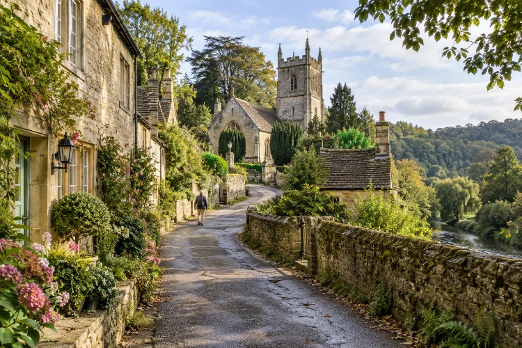
At first glance, Limpley Stoke looks like a peaceful English village shaped mainly by wooded hills, stone houses, and the River Avon. Look a little closer, however, and its landscape begins to reveal a much longer story.
Understanding how Limpley Stoke evolved from Saxon settlement to rural village means following centuries of population change, religion, cloth production, road building, quarrying, and railway development.
The settlement did not simply grow outward from one fixed centre. Parts of the original community disappeared, new neighbourhoods emerged, industries arrived and declined, and historic buildings were repeatedly adapted to new purposes.
Limpley Stoke’s position on the western side of the Avon also played a major role. The river provided water power, while the steep valley influenced where homes and roads could be built.
Later, the same valley attracted railway engineers and made the area well connected to Bath and Bradford on Avon.
The result is a small village with a surprisingly complex past hidden beneath its rural appearance.
Saxon Origins Created the Foundations of Limpley Stoke
Limpley Stoke formed part of the historic Hundred of Bradford, an administrative area with roots in the Anglo-Saxon period. Wiltshire’s community history records that the settlement was once known as Hanging Stoke or Stook, while the name Limpley Stoke is first documented in 1585.
The word “Stoke” comes from the Old English stoc. Its exact meaning could vary, but it was commonly associated with a settlement or outlying place. In this case, the name fits a small community positioned on steep ground above the Avon Valley.
The early village, known as Hanging Stoke, stood around and to the south-east of what is now St Mary’s Church. Its location placed it close to the river while still occupying higher ground overlooking the valley.
Even earlier activity had taken place nearby. Archaeological evidence includes Roman settlement remains around Midford Lane and land close to the later church, suggesting that this part of the Avon Valley had attracted people long before the Saxon community emerged.
St Mary’s Church Preserves the Saxon Story
Few buildings illustrate the depth of Limpley Stoke’s history better than the Church of St Mary.
Historic England dates parts of the church to the tenth century, with later construction from the early thirteenth and fifteenth centuries. One particularly valuable survival is a Saxon arch, now incorporated into the church interior.
The church was once dedicated to St Edith of Wilton and functioned historically as a chapelry connected with Bradford on Avon.
Although much of the structure visible today reflects later medieval and modern alterations, its pre-Conquest origins connect the present village directly with Anglo-Saxon England.
That continuity matters. Settlements often shift, buildings disappear, and land uses change, but churches can preserve the location and memory of communities that otherwise leave only limited visible evidence.
For visitors today, St Mary’s is therefore more than an attractive historic building. It provides a physical reference point for understanding where early Limpley Stoke began.
The Black Death Changed the Village’s Geography
One of the most dramatic turning points arrived in the fourteenth century.
According to Wiltshire’s local history records, the Black Death of 1348-49 devastated the original settlement, almost wiping out the community around Hanging Stoke.
Rather than simply rebuilding the village exactly where it had stood, later inhabitants gradually developed another settlement pattern farther north.
This shift demonstrates something easy to overlook when studying rural history. Villages are not always permanent arrangements of houses and lanes. Disease, economic opportunity, access to water, land ownership, and transportation can completely alter their geography.
By the fifteenth century, a newer community was emerging in what became Middle Stoke. Its growth was closely connected with an industry that would influence the district for centuries: woollen cloth production.
The medieval disaster therefore unintentionally became part of a larger transition. The old Saxon settlement declined, while a more economically specialised village began taking shape nearby.
Wool and Water Created a New Village Centre
The River Avon became one of the strongest forces behind Limpley Stoke’s later developement.
Water power was essential to medieval and early modern cloth production. Limpley Stoke Mill was being used for fulling woollen cloth by 1376.
Fulling involved cleaning, thickening, and finishing woven material, and mechanised fulling mills could use waterwheels to reduce the enormous amount of manual labour required.
By around 1500, cloth production was providing employment locally, and weavers’ cottages appeared around Middle Stoke. Inns, a bakery, a cider house, and eventually other community facilities developed around the growing settlement.
The mill eventually became far more substantial. Between 1796 and 1822, Bush, Newton & Bush operated a factory there, with about 200 people reportedly employed in 1816. That figure helps challenge the modern impression of Limpley Stoke as an entirely sleepy rural community.
For a period, this was a working industrial landscape connected to the much wider West Country woollen economy.
Roads, Estates, and Services Reshaped the Village
The seventeenth, eighteenth, and early nineteenth centuries introduced another phase of change.
Local families including the Dickes, Fishers, and Coopers became closely associated with land ownership, brewing, cloth production, and important houses in the settlement.
Waterhouse, Weir House, the Manor, farms, cottages, and other properties reflected a social landscape where agricultural land and local industry existed side by side.
Improved transport also mattered. A more substantial stone bridge across the Avon was completed in 1751, replacing an earlier wooden crossing. Tolls continued to be collected there until 1861.
Another major structure arrived in 1834, when the Limpley Stoke Viaduct was built to carry the Bath-to-Warminster road. Historic England lists the stone viaduct at Grade II, preserving an important example of nineteenth-century road engineering.
Together, these changes brought the village into closer contact with neigbouring communities and regional markets while leaving much of its older landscape intact.
The Railway Brought Victorian Limpley Stoke Into a Wider Network
Industrial-era transport changed the village again when Limpley Stoke railway station opened in 1857.
The station formed part of the rail connection between Bradford on Avon and Bathampton. It did more than carry passengers. A goods yard was used to load building stone from nearby quarries, showing how railway infrastructure supported another important local industry.
Limpley Stoke became a junction in 1910 when an extension of the Camerton branch opened. Coal from the Somerset Coalfield became an important source of freight traffic, although passenger services on the branch were relatively limited.
The main station eventually closed to passengers in 1966, although the railway line itself remains active.
The arrival and decline of rail transport reflects a broader pattern seen across rural Britain. Victorian infrastructure made small settlements more accessible, but widespread car ownership later reduced dependence on village stations.
From Working Settlement to Desirable Rural Village
Limpley Stoke experienced social as well as economic changes during the nineteenth and twentieth centuries.
Wiltshire’s community history records 377 residents in the 1841 census and 414 by 1901. During this period, villagers could find trades including tailoring, shoemaking, brewing, carpentry, building, quarrying, shopkeeping, and railway employment.
There were also schools, chapels, inns, hotels, and even a hydropathic health establishment. The village was never simply an agricultural cluster; it combined rural life with manufacturing, transport, tourism, and local services.
As traditional industries declined, however, the character of the settlement changed. Mills found different uses, quarrying became less dominant, the village school closed in 1932, and the railway station eventually disappeared from the passenger network.
At the same time, proximity to Bath and Bristol made Limpley Stoke increasingly attractive as a residential location. Its rural scenery, historic buildings, and transport connections gradually became advantages for commuters rather than industral workers.
Why Limpley Stoke Still Feels Historically Layered
Modern Limpley Stoke has never completely seperated itself from its earlier identities.
The Saxon church remains. Medieval settlement patterns can still be understood through the location of Church Lane and Middle Stoke.
The old mill represents centuries of water-powered industry, while bridges, stone houses, railway remains, and the 1834 viaduct preserve later phases of development.
Even the landscape tells part of the story. The steep slopes explain why development is concentrated in particular areas, while the river helps explain the historical importance of milling, transport, and industry.
This makes Limpley Stoke rewarding to explore slowly. Instead of seeing isolated old buildings, visitors can read them as parts of one evolving system.
A church represents the original settlement. A mill reveals economic change. A railway structure marks Victorian mobility. Together, they show how a small community continually adapted without completely losing its past.
The story of how Limpley Stoke evolved from Saxon settlement to rural village is not a simple journey from old to new. The community moved, rebuilt, industrialised, became connected by road and rail, and eventually shifted toward a quieter residential identity.
Its Saxon church, medieval cloth heritage, historic mill, Georgian and Victorian infrastructure, and surviving stone buildings make those transitions unusually visible.
Behind today’s peaceful Avon Valley scenery lies a history shaped by disease, industry, engineering, trade, and changing patterns of everyday life.
If you visit Limpley Stoke, take time to explore beyond the main road. Follow the older lanes, look at how buildings relate to the river and hillside, and visit the historic church area.
Once you understand its evolution, the modern village becomes much more than a pretty rural stop.
