

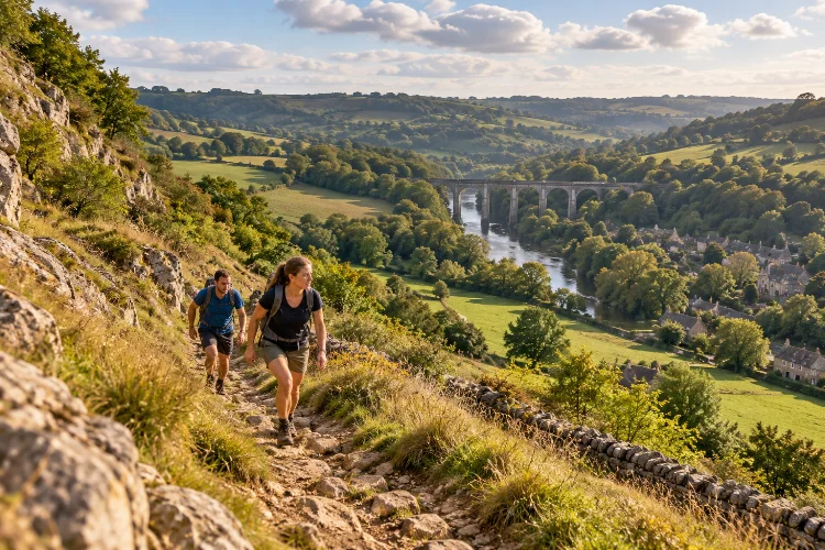
Limpley Stoke and Freshford sit remarkably close together, but walking between them can feel like travelling through several different landscapes.
One moment you are climbing steep lanes above the Avon Valley; the next you are crossing open fields, descending through woodland, or following water toward an old aqueduct.
That variety makes advanced walking routes linking Limpley Stoke and Freshford especially appealing to walkers who want something more challenging than a short village stroll.
The official Two Church Circular provides a useful foundation, but experienced walkers can build longer routes by connecting it with riverside paths, higher valley trails, the Kennet & Avon Canal, and sections of the Greater Avon Valley Way.
The terrain is not mountainous, yet it deserves respect. Short, sharp climbs, muddy descents, uneven surfaces, and repeated elevation changes can make modest distances surprisingly demanding.
Add convenient railway access at Freshford and nearby Avoncliff, and the area becomes ideal for creating flexible half-day and full-day routes without relying on a car.
Start With the Two Church Circular as Your Base Route
The logical foundation for almost any Limpley Stoke–Freshford walk is the Two Church Circular.
Published by Cotswolds National Landscape, the route covers around 2 miles (3.22 km) and links St Peter’s Church in Freshford with St Mary’s Church in Limpley Stoke.
Although officially rated for basic countryside fitness, it includes around 95 metres of ascent and descent, unsurfaced paths, steps, fields, and a steep section that can become muddy.
That makes it more useful than its short distance suggests.
From Freshford, the route climbs past St Peter’s before passing woodland and fields toward Crowe Lane. Crowe Hill then leads toward steep steps below St Mary’s Church in Limpley Stoke. The return crosses open ground before descending toward the River Frome.
For experienced walkers, however, think of this circuit as a framework rather than the entire adventure. Its paths give you several opportunities to connect with longer valley routes instead of immediately returning to the starting point.
Add Crowe Hill for a Steeper Valley Experience
Crowe Hill is one of the sections that gives the short circular its character.
The official route follows Crowe Lane before climbing steep steps toward St Mary’s. Along the way, walkers are encouraged to look back across the Limpley Stoke Valley, where the surrounding hills reveal how tightly the villages sit within the landscape.
For a stronger workout, tackle this section from the Freshford side while you are still fresh rather than saving it for the end of a longer day.
Once you reach St Mary’s, resist the temptation to descend immediately. Spend some time on the higher ground around Limpley Stoke before returning toward the valley floor.
St Mary’s itself adds historical interest to the route. Historic England records parts of the Grade II* church from the tenth century, alongside thirteenth-, fifteenth-, and later architectural work.
Combining steep terrain with a genuine heritage landmark makes this section particularly rewarding.
Build a Longer Loop Using the Greater Avon Valley Way
Walkers looking for more mileage can use the wider Greater Avon Valley Way network.
Bristol Ramblers describes its Bradford-on-Avon-to-Bath section as a 16-mile undulating route that crosses both sides of the Avon, incorporates two aqueducts, and includes wooded climbs and higher ground.
Importantly for local walkers, the route passes through Limpley Stoke and can be shortened by heading south toward Freshford station.
Another section passes through Winsley and close to Murhill Bank before descending toward the B3108, crossing the canal and River Avon, and entering Limpley Stoke. The route includes viewpoints across the valley and another climb through the village.
You do not have to complete the full 16 miles.
A more practical advanced variation is to use parts of this long-distance route to add higher ground north or east of Limpley Stoke, then return toward Freshford using established local footpaths.
Because rights of way and temporary diversions can change, plan the exact connection using a current OS or public-rights-of-way map rather than improvising through farmland.
Link Freshford With the River Avon for a Lower-Level Return
A satisfying advanced route should vary the terrain instead of repeating the same hills in both directions.
After crossing the higher paths between Freshford and Limpley Stoke, use the Avon Valley floor for part of the return journey.
Visit Bath specifically recommends Freshford as a base for walking beside the River Avon toward Avoncliff. Freshford sits within the Limpley Stoke Valley and offers easy access to surrounding countryside despite being only a short train ride from Bath.
This riverside environment feels very different from Crowe Hill.
The slopes are less immediate, the landscape opens out, and the route draws attention to the river, railway, meadows, and wooded valley sides. After a series of climbs, this change of rhythm can be welcome.
Do remember that valley-floor paths can become muddy after prolonged rainfall. The official Two Church route also notes frequent flooding beside the River Frome following heavy rain, so wet conditions should influence your route choice.
Extend the Walk From Freshford to Avoncliff
For a genuinely substantial outing, do not stop at Freshford.
Continue east through the valley toward Avoncliff. Visit Bath highlights this as a scenic countryside connection, with the option to join the Kennet & Avon Canal once you reach the aqueduct.
Avoncliff Aqueduct makes a natural objective.
The Grade II listed structure is more than 100 metres long and carries the Kennet & Avon Canal above the River Avon. From here, the canal can be followed either toward Bradford-on-Avon or west toward Dundas.
This extension works particularly well for stronger walkers because it combines several environments in one trip: Limpley Stoke’s steep streets, rural fields around Freshford, river paths, and finally the relatively level canal towpath.
It also solves an important logistical problem. Avoncliff railway station sits beside the aqueduct, allowing you to finish there instead of walking every mile back.
That makes longer linear routes much more accessable.
Create a Full Valley Circuit via Dundas Aqueduct
If a half-day walk is not enough, continue west along the canal toward Dundas.
The section between Avoncliff and Dundas runs through one of the most interesting transport landscapes in the valley. Canal, railway, river, historic roads, and wooded slopes repeatedly come together within a narrow corridor.
Dundas Aqueduct carries the Kennet & Avon Canal over the Avon and marks the junction with the surviving section of the Somerset Coal Canal at Brassknocker Basin.
The Canal & River Trust describes the site as a Scheduled Monument and notes surviving features around Dundas Wharf, including its tollhouse, warehouse, and crane.
The canal stretch between Dundas and Avoncliff is roughly 4 km each way according to Canal & River Trust visitor information.
Combining this with Freshford and Limpley Stoke produces a much more serious outing.
One independent mapped walk linking Freshford, Limpley Stoke, Dundas, and Avoncliff measures about 11.75 km with 435 metres of total ascent, illustrating how quickly elevation accumulates when the valley’s higher paths are included.
Treat such figures as a guide rather than a promise, since your exact distance will depend on the connections chosen.
Use Rail Stations to Design Better Linear Walks
Advanced route planning is often easier when you stop insisting on a circular walk.
Freshford station provides rail access from Bath, Bradford-on-Avon, and surrounding towns, while Avoncliff station sits farther east beside the aqueduct. Current tourism guidance actively recommends both stations as starting points for Avon Valley walks.
That creates several useful possibilities.
You could begin at Freshford, climb through Limpley Stoke, add higher valley paths, return through Freshford, and continue to Avoncliff. Alternatively, start from Avoncliff and work west toward Freshford before taking on the steeper Limpley Stoke section later.
A linear route also means every mile can show you something new.
For experienced walkers, this is usually more satisfying than doubling back along identical terrain simply because the car is parked at the starting point.
Check current train times before leaving, particularly for evening services.
Understand Why Short Routes Can Still Feel Hard
Distance alone is a poor measure of difficulty around Limpley Stoke.
Repeated elevation change is the real challenge. The official two-mile circular already packs in approximately 95 metres of climbing and descending. Longer variations can quickly multiply that figure.
Underfoot conditions also matter.
Grass fields can become slippery, wooded descents stay damp, and narrow paths may be much slower after rain. By contrast, the canal towpath generally allows a faster walking rhythm, although sections can still be rough or uneven.
For an advanced route, a useful strategy is to put the steepest climbs into the first half of the day and use the canal or river corridor later.
That produces a more interesting route while reducing the chance that tired legs have to tackle a final major ascent.
The valley’s compact appearance can be misleading; its scenry rewards walkers who manage their energy rather than simply covering miles quickly.
Pack for Countryside Conditions, Not Village Streets
Limpley Stoke and Freshford may look polished and residential, but the connecting footpaths are genuine rural terrain.
Trail shoes or walking boots with good grip are preferable after wet weather. Carry a lightweight waterproof, water, snacks, and an offline map or downloaded GPX file for longer variations.
Cotswolds National Landscape specifically warns that the steep descent on the Two Church Circular may be muddy, while the River Frome can flood following heavy rainfall.
Parking is another reason to consider public transport. The official walking guidance notes that parking on Freshford’s narrow roads can be difficult and recommends arriving by bus or train where practical.
Finally, distinguish between visible tracks and legal public paths. The valley contains plenty of inviting-looking farm lanes, but not every one offers public access.
Advanced walking should mean better planning, not simply taking more risks with navigation.
Advanced walking routes linking Limpley Stoke and Freshford become much more interesting once you move beyond the basic two-mile village circuit.
Crowe Hill provides steep terrain and excellent valley perspectives, the Greater Avon Valley Way opens possibilities for longer hill sections, and the River Avon creates a contrasting lower-level route.
For a bigger challenge, continue from Freshford toward Avoncliff and link into the Kennet & Avon Canal. Strong walkers can extend farther toward Dundas, creating a varied day of climbs, fields, riverside paths, aqueducts, and historic transport corridors.
Use Freshford and Avoncliff stations strategically, check current rights of way, and adapt your route to weather conditions.
Rather than chasing the longest possible distance, combine elevation, heritage, and changing terrain. That is where walking this neigbouring pair of Avon Valley villages becomes genuinely memorable.
