

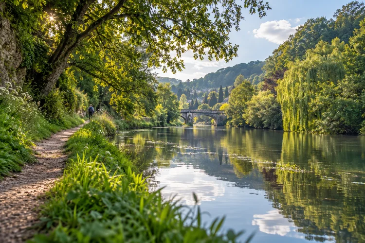
There is something especially relaxing about walking beside water, and the landscape around Limpley Stoke offers several ways to do it.
The River Avon winds through a narrow green valley while footpaths, old lanes, railway lines, and the Kennet & Avon Canal follow roughly the same natural corridor.
Exploring riverside footpaths around Limpley Stoke and the Avon is not quite as simple as choosing one continuous path beside the river.
Some sections stay close to the Avon, others climb briefly through fields or villages, while nearby canal towpaths provide a flatter alternative when riverside ground becomes wet.
That variety is actually what makes the area so enjoyable. You can begin among the limestone buildings of Limpley Stoke, cross countryside toward Freshford, follow the river toward Avoncliff, and then switch to the canal beside one of England’s most attractive historic aqueducts.
With railway stations at Freshford and Avoncliff, it is also easy to create a one-way walk rather than retracing every step.
Understand the Avon Valley Before Choosing Your Route
The first useful thing to know is that the best local walking does not always stay directly beside the River Avon.
Limpley Stoke sits above a relatively narrow valley containing several different transport corridors.
The Avon occupies the bottom, while the railway, local roads, and Kennet & Avon Canal compete for space nearby. That means public paths frequently move between riverside meadows, higher fields, village lanes, and towpaths.
This is good news for walkers because it creates natural route variations.
If the riverbank is muddy, you can often use higher ground or a canal section instead. If you want broader views, climb toward Limpley Stoke or Freshford before returning to the valley floor.
The result is less of a single riverside trail and more of an interconnected walking landscape.
Start With Limpley Stoke and the Freshford Connection
A good introduction begins by linking Limpley Stoke with neighbouring Freshford.
The official Two Church Circular from Cotswolds National Landscape is approximately 2 miles (3.22 km) and takes about an hour.
It connects St Mary’s at Limpley Stoke with St Peter’s Church in Freshford while passing fields, woodland, Crowe Hill, and the River Frome. The route includes around 95 metres of ascent and descent, so it provides more variety than its short distance suggests.
Although the River Frome is not the Avon, this section works well as an entry route into the wider river landscape. Freshford sits close to the point where the smaller river meets the Avon Valley.
The walk also provides excellent views across Limpley Stoke before descending toward lower ground.
Be aware that the riverside area near the River Frome can flood after heavy rain, while the steep path may become muddy.
For that reason, this route is especially enjoyable after a period of relatively dry weather.
Follow Freshford Toward Avoncliff Beside the Avon
Freshford is one of the most useful starting points for a longer riverside walk.
Visit Bath specifically recommends the village for walks along the River Avon toward Avoncliff. Freshford sits within the Limpley Stoke Valley and is only a short rail journey from Bath, making it practical even for walkers travelling without a car.
The character of the landscape changes quickly once you leave the village.
Fields open beside the river, woodland rises on the valley slopes, and the railway occasionally appears between trees. The scenery feels much more secluded than its location close to Bath might suggest.
This section is ideal for walkers who prefer natural scenary rather than major landmarks every few minutes. The attraction is the rhythm of the valley itself: moving water, pasture, trees, old stone boundaries, and glimpses of settlements above the river.
After prolonged rain, expect softer ground and muddy patches. Carrying waterproof footwear is sensible even when the overall forecast looks good.
Make Avoncliff the Centrepiece of the Walk
Avoncliff gives the route a clear destination.
Here, the Kennet & Avon Canal crosses high above the River Avon on Avoncliff Aqueduct. The Grade II listed structure is more than 100 metres long and 18 metres wide, making it one of the most striking pieces of historic infrastructure in the valley.
It is worth viewing the aqueduct from several levels.
From below, you can appreciate its scale against the river. From the towpath above, the perspective changes completely as canal boats pass across the valley while the Avon runs below.
This is also where riverside walking and canal walking naturally meet.
Avoncliff railway station sits close to the aqueduct, which makes the hamlet an excellent finishing point for a linear walk from Freshford or Limpley Stoke.
That rail connection is useful if muddy ground or tired legs make the return journey less appealing.
Use the Kennet & Avon Towpath as a Riverside Alternative
Although the Kennet & Avon Canal is obviously not the River Avon, its towpath is one of the easiest ways to continue exploring the same valley.
Cotswolds National Landscape publishes a 6.5-mile return route between Brassknocker Basin near Dundas and Avoncliff. The trail is described as easy and scenic, with no road crossings on the published route, although the surface can be stony and bumpy.
This section is useful because it offers a different walking experience from the natural riverbank.
The towpath is generally easier to follow, gradients are gentle, and trees provide shade during warmer months. You still remain closely connected to the Avon because the river, railway, and canal repeatedly run beside or cross one another.
For a longer day, walking from Freshford to Avoncliff beside the river and then continuing west along the canal creates a satisfying mix of wild and engineered waterways.
It also avoids simply walking back along the same route.
Continue Toward Dundas Aqueduct
Dundas Aqueduct makes an excellent objective if you want to extend the walk farther west.
Completed in 1810, the aqueduct carries the Kennet & Avon Canal across the River Avon. It also stands close to the junction with the surviving section of the Somerset Coal Canal at Brassknocker Basin.
Historic features around Dundas include the old wharf, tollhouse, warehouse, and crane.
That makes the area interesting even if you are primarily walking for scenery rather than history. Instead of following one completely natural watercourse, you can see how nineteenth-century engineers transformed the same valley into a transport route.
The paths around Dundas are also relatively accessable compared with some of the hillier routes near Limpley Stoke.
Cotswolds National Landscape describes the approach from the local car park toward the aqueduct as largely level with only short gentle climbs.
Extend East Toward Bradford-on-Avon
If you prefer to continue downstream rather than head back toward Dundas, walk east from Avoncliff toward Bradford-on-Avon.
An established Cotswolds National Landscape route between Bradford-on-Avon and Avoncliff combines riverside walking with the canal. The approximately 3-mile (4.8 km) route passes through Barton Farm Country Park before reaching Avoncliff Aqueduct.
Part of the route follows a grassy riverside path beside the Avon.
This section is especially attractive because the river and canal run close together while still feeling very different.
On the riverside path, the environment feels softer and more natural; move onto the towpath and the character becomes more structured, with boats, bridges, and historic engineering.
Barton Farm adds another layer, with historic agricultural buildings and open meadowland beside the water.
Combining Freshford, Avoncliff, and Bradford-on-Avon creates a much longer linear walk while keeping railway stations available at several points.
Look for Wildlife Along the Water
Riverside walking is often most rewarding when you stop treating the route as something to complete quickly.
The Avon and canal corridor supports a variety of waterside wildlife. Around Avoncliff, the Canal & River Trust highlights water birds, wildflowers including foxgloves and red clover, and occasional sightings of deer, badgers, and bats around the aqueduct.
Kingfishers are also associated with this stretch of the canal and river system, although spotting one usually requires patience and a little luck.
Early morning can be particularly enjoyable because the paths are quieter and wildlife disturbance is lower.
Even if you are not a dedicated birdwatcher, slowing down beside the river changes the experience completely. Watch reed beds, overhanging branches, shallow water, and quieter stretches away from bridges.
A twenty-minute pause beside the Avon can sometimes be more memorable than covering another two miles.
Plan Around Rain, Mud, and River Levels
The main challenge with Avon Valley walking is not distance. It is weather.
Low riverside ground can become saturated after sustained rain, while the Two Church Circular specifically warns of frequent flooding near the River Frome. Steeper unsurfaced paths can also become slippery.
If conditions are wet, build flexibility into your route.
A good strategy is to use higher paths between Limpley Stoke and Freshford, check the condition of riverside sections, and switch to the canal towpath if necessary.
Wear footwear with proper grip rather than assuming that a village walk means smooth surfaces.
Public transport also gives you an escape option. Freshford and Avoncliff both have railway access, while Visit Bath promotes these stations as convenient gateways for exploring the valley on foot.
That makes it easier to adjust your plans without turning back.
Exploring riverside footpaths around Limpley Stoke and the Avon is less about following one perfect trail and more about combining several complementary routes.
Limpley Stoke and Freshford provide higher village paths, the Avon offers quiet meadow and riverside walking, and Avoncliff connects those natural landscapes with the Kennet & Avon Canal.
From there, you can continue west toward Dundas Aqueduct or east toward Bradford-on-Avon, creating anything from a short two-hour walk to a full-day journey.
The best approach is to remain flexible. Check recent weather, carry suitable footwear, and use rail connections to create a linear route.
Most importantly, spend time beside the water rather than racing through it. The valley is at its best when the river, wildlife, old engineering, and surrounding hills are given time to reveal themselves.
