

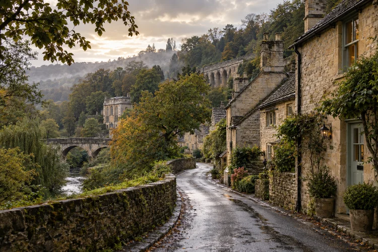
Limpley Stoke can easily give the impression that it has always been a quiet rural village.
Stone cottages climb the wooded side of the Avon Valley, historic buildings sit among mature trees, and the surrounding countryside creates the kind of peaceful atmosphere associated with traditional Wiltshire.
The reality is considerably more complicated.
The hidden historical layers behind Limpley Stoke’s village character include Roman activity, a Saxon settlement, medieval population disruption, woollen manufacturing, wealthy landowners, road engineering, quarrying, railways, tourism, and even an early rubber industry.
Each period changed how people lived and where the village developed.
What visitors see today is therefore not one preserved historic settlement. It is the result of centuries of adaptation.
The church recalls the earliest community. Middle Stoke reflects the expansion of cloth working. The river points toward industrial history, while the railway and road viaduct reveal the arrival of faster regional connections.
Understanding these overlapping stories transforms Limpley Stoke from a picturesque village into something far more interesting: a landscape where different eras remain visible at the same time.
The Landscape Was Important Before the Village Existed
Limpley Stoke’s position in the Avon Valley has influenced almost every stage of its history.
The present settlement rises westward from the River Avon, with woodland occupying parts of the higher ground. Wiltshire’s community history also records evidence of Roman occupation nearby, including remains around Midford Lane and another settlement close to the later church.
Evidence of a Roman route linking the wider Bath area with destinations farther south has also been identified.
These clues matter because they show that Limpley Stoke did not suddenly appear during the medieval period. People had already recognised the advantages of this landscape.
The valley offered water, agricultural land, woodland, and natural routes through otherwise difficult terrain. Much later, the same geography would attract mills, roads, railway engineers, and industrial businesses.
In other words, the physical landscape provided the framework. Different generations simply found new ways to use it.
A Saxon Settlement Lies Beneath the Modern Village Story
Limpley Stoke belonged historically to the Bradford Hundred, an administrative division with Saxon origins.
The place was once known as Hanging Stoke or Stook, with the name Limpley Stoke appearing much later. The element “Stoke” derives from the Old English stoc, broadly associated with a place or settlement.
The original Saxon community occupied ground east and south of today’s Church of St Mary.
The church itself provides one of the strongest surviving links to this early period. Historic England records fabric dating to the tenth century, followed by additions from the early thirteenth and fifteenth centuries. The church is now protected as a Grade II* listed building.
This makes St Mary’s particularly valuable when reading the village landscape. Buildings around it have changed, settlement patterns have shifted, yet the church area still identifies the centre of a community that existed before the Norman Conquest.
Its survival gives Limpley Stoke a historical depth that is easy to miss when simply passing through.
The Black Death Helped Shift the Village Centre
One of the village’s least visible historical layers comes from catastrophe rather than construction.
Wiltshire’s local historical record states that the Black Death of 1348-49 almost completely destroyed the original Hanging Stoke settlement. During the fifteenth century, a new community gradually developed farther north, forming the area now associated with Middle Stoke.
That shift helps explain why Limpley Stoke does not have one straightforward historic core.
Instead, its geography reflects disruption and recovery. The church marks the earlier settlement, while later homes and commercial activity concentrated elsewhere.
This is a useful reminder that village landscapes often contain absences as well as surviving buildings. A field, churchyard, or unusual gap between groups of houses can sometimes reveal historical change just as clearly as a medieval cottage.
Limpley Stoke’s village character was therefore partly shaped by a settlement that largely disappeared.
Cloth Making Turned a Rural Community Into a Working Centre
The River Avon eventually helped generate a very different kind of village.
Limpley Stoke Mill was associated with woollen cloth production by 1376, when it was being used for fulling. Fulling cleaned and thickened woven wool fabric, and water-powered machinery made the process more efficient than purely manual methods.
As textile work grew, the new Middle Stoke settlement expanded. Wiltshire’s community history records that weavers’ cottages appeared by around 1500, while businesses such as an inn, bakery, and cider house developed around the new centre.
The scale of later industry might surprise anyone who knows Limpley Stoke only as a rural residential village.
Between 1796 and 1822 the mill was operated by Bush, Newton & Bush. By 1816, the factory employed around 200 people, making it a significant source of local employment.
The apparently timeless countryside was therefore once connected to a busy industral economy where water, machinery, workers, and merchants shaped daily life.
Wealth, Estates, and Houses Added Another Social Layer
Industry did not only produce workers’ housing. It also helped create wealth that became visible in the village landscape.
Families such as the Dickes, Fishers, and Coopers had substantial interests in Limpley Stoke.
They were associated with cloth making, brewing, estates, and important local properties. Wiltshire’s records describe houses including Waterhouse, Weir House, the Manor, and other properties connected with these families.
This helps explain the architectural variety found across the settlement.
Small cottages represent one level of village society, while larger residences reveal a very different world of landownership, commerce, and social status. The contrast between them preserves something of the hierarchy that shaped rural communities for centuries.
Some buildings also changed functions dramatically. Limpley Stoke Manor, for instance, was used as a girls’ reformatory school during part of the nineteenth century before eventually returning to other uses.
The historical landscape was never static. Properties were enlarged, repurposed, sold, and adapted as village life changed.
Roads and Railways Opened the Village to a Wider World
The nineteenth century brought increasingly ambitious transport infrastructure into the valley.
One of the most prominent examples is Limpley Stoke Viaduct. Historic England dates the Grade II listed structure to 1834.
Built to carry the Bath-to-Warminster road, its sequence of stone arches demonstrates how road engineers began overcoming the valley terrain with large permanent structures.
The railway created an even greater transformation.
Limpley Stoke station opened in 1857 when the Bradford-to-Bathampton railway link was completed.
Its goods facilities handled building stone from nearby quarries, while the station later became a junction following the extension of the Camerton branch in 1910. That branch carried substantial coal traffic from the Somerset Coalfield.
Passenger services at the main station ended in 1966, although the station building survives.
These developments meant Limpley Stoke was no longer simply connected to neigbouring villages by traditional roads. It became part of larger regional systems moving passengers, coal, stone, and other goods.
The Village Even Became a Victorian Health Destination
Another unexpected layer of Limpley Stoke’s history involves Victorian ideas about health and leisure.
The West of England Hydropathic Establishment opened in 1863 on the site of, and possibly partly incorporating, the older Stoke Farm. Designed by architect William Jervis Stent, it offered water therapies under the supervision of a resident physician.
Its location close to Bath was significant. Victorian enthusiasm for spa treatments and hydropathy created demand for establishments combining health, accommodation, fresh air, landscaped surroundings, and water-based treatments.
The building later evolved into the Limpley Stoke Hotel as interest in hydropathy declined. Alterations and additions were designed by George Lawrence in 1915, and by 1936 it was operating simply as a hotel.
This transition shows another recurring pattern in the village: old sites finding new purposes rather than simply disappearing.
Industrial Decline Helped Create Today’s Rural Character
Perhaps the biggest historical illusion in modern Limpley Stoke is the idea that its rural atmosphere represents continuity.
In reality, some of that peaceful character emerged because earlier industries disappeared.
The mill went through numerous uses. Bradford on Avon Museum records its history as a corn mill, woollen fulling mill, factory, and later industrial site.
Rubber manufacturing also began at the disused mill in 1875 before the business that eventually became associated with Avon Rubber moved to Melksham in 1889.
Railway passenger services eventually disappeared, traditional industries declined, and employment became less tied to mills, quarries, and local estates.
At the same time, easy access to Bath and Bristol increasingly made the village attractive as a residential location. Wiltshire’s community history describes Limpley Stoke as becoming a desirable place to live because of these connections.
Today’s rural identity is therefore partly a product of economic transition rather than the survival of an unchanged agricultural past.
Reading the Hidden History in Today’s Village
The best way to understand Limpley Stoke is to stop looking for a single historic centre.
Instead, think of the village as a series of overlapping landscapes.
The church represents the Saxon and medieval settlement. Middle Stoke reflects post-Black Death recovery and textile growth. The mill connects the river with centuries of economic activity.
The viaduct and railway reveal nineteenth-century transport ambitions, while the former hydropathic establishment represents changing ideas about leisure and health.
Even buildings that seem unrelated can make sense when viewed together.
A workers’ cottage becomes more meaningful once you understand cloth production. A large house says something about wealth generated by land and commerce. Railway remains make more sense when connected with quarrying and coal traffic.
This approach turns a simple walk through Limpley Stoke into something closer to reading a historical document – except the document is made from stone, roads, waterways, slopes, and buildings.
The hidden historical layers behind Limpley Stoke’s village character reveal a community that has changed repeatedly rather than remaining frozen in rural tradition.
Roman activity, Saxon settlement, medieval disease, woollen manufacturing, wealthy estates, Victorian transportation, hydropathy, and industral decline have all left traces.
What makes the village special is how those traces continue to overlap. Its church, cottages, mill landscape, historic houses, railway remains, and road infrastructure belong to different centuries but still contribute to one recognisable place.
When visiting Limpley Stoke, slow down and look beyond the postcard scenery. Follow the relationship between the hillside, river, buildings, and transport routes.
Once those connections become visible, the village’s apparently simple rural character reveals a far richer and more complicated past.
